Tag Archives: america

Alabama Problem


Crossing MississippiI went to America again and had lots of fun there. I guess there is no surprise here. It was quite a few weeks ago but since then I’m still battling my laziness to come up with more blog posts. But don’t you worry, some of them might be coming quite soon.

In the meantime, in a rare moment of mobilisation, I decided to create a map of my American experiences up to date. The results of my effort is this awesome map showing all the places I have visited during my travels since 2001. And it was quite an effort as I had to place more than 200 markers indicating cities, towns and villages as well as natural and man made attractions which I got under my belt. Being a geek I even marked all the airports I used during my trips, including their IATA (International Air Transport Association) codes. I’m actually quite proud of my map.

However as a side effect of this whole mapmaking exercise I realised that I might be a bit of a cheat. Let me explain.

Do you remember how some time ago, after stopping in Rhode Island, I claimed that I have visited all the lower 48 states? Well, there is a bit of a problem. If you look at my map you might realize that Montana and Alabama look devoid of the markers. I can probably get away with Montana as if you look closely you can spot lonely marker in West Yellowstone, a small town just outside of Yellowstone National Park, located in a small bit of Montana wedged between Wyoming and Idaho. I definitely stopped there for a few hours and I even remember chatting with a Subway franchise owner about his experiences with employing Eastern European students during the summers.West Yellowstone

If my claim of visiting Montana is a bit of a stretch then Alabama is a huge problem. I definitely drove across its gulf panhandle during my first transcontinental journey in 2001 as we followed the I-10 back then. But I don’t really think we stopped there. Well, we might have briefly stopped for a loo but even that is dubious. Besides, stopping for a gas or a toilet break doesn’t really count according to my own rules. It seems that if I want to be honest with myself I have to remove Alabama from my list of visited states.

Am I disappointed? Maybe a bit, but on the other hand I now have an excuse to visit the Southern USA again. I even started peeking at maps looking for ideas about driving around Alabama. There is a slight problem however with finding guidebooks as it seems that there is very little written about the Yellowhammer State (as it is sometimes called). In fact I had the same problem before going to Mississippi. Both states are not really well covered by guidebooks. Neither of them gets more than a few pages in guidebooks covering the whole USA. I understand that it is a big country and that it is difficult to cover all the 50 states in detail in one book (especially if we don’t want the book to be the size of Titanic) but I struggle to understand the lack of specific guidebooks. Maybe not necessarily for Alabama alone but at least for the whole Deep South. I know from my professional experience that there is an interest (at least among the Brits) but somehow all the big publishers ignore the region. I’m not sure if Lonely Planet will really sell more guidebooks to Vanuatu, Rarotonga or East Timor or Bradt for Sierra Leone or Sudan, than they would for the Deep South.

But all this will only make planning my future trip to Alabama more interesting. Maybe when I come back I should offer a helping hand to LP or Rough Guide?

2014 Southern RouteAnyway, my next US trip will not be any time soon as I promised my girlfriend that for our next holiday we’ll go somewhere else. And honestly I have to agree that I can’t drag her there all the time. As we know life is all full of compromises. But Alabama is definitely hanging out there as a possible option when I have some spare holiday to use.

In the meantime I promise stories from my latest trip which was of course full of big destinations and popular attractions as well as some lesser, or even absolute niche sites.


Heart of the American Southwest

Lush Monument ValleyThis part of the country is as iconic as it gets. Probably most people on the planet have seen images of it either in books or in countless movies, especially the classic westerns. You must have seen them too.

I had visited this region just a few years ago so it was interesting to be back.

You might ask why come back? Well, it is a bit complicated. First, I wanted to show my girlfriend (who is an archaeologist) some of the sites associated with the ancient American cultures, namely the Ancestral Puebloans’ ruins in Mesa Verde National Park. But I also like to come back to some places in general. Somehow while revisiting a particular location I do notice more things. I guess the reason for that is the fact that when you arrive at some very exciting destination for the first time it is easy to be overwhelmed and distracted. It is simply too difficult to take it all in. Somehow, a repeated visit is usually less frenetic, calmer, and it simply lets you notice more. It also allows you to see things in different conditions, for example in different weather.

And that’s precisely what I experienced when we arrived at the famous Monument Valley. Two years ago during my previous trip the weather conditions were challenging, to say the least. It was rainy, it was windy and visibility was not too great. Don’t get me wrong, I’m not complaining, I still loved every moment of the experience, it was just different. This year the weather was perfect. Warm, but not too hot, with beautiful sunshine. We also managed to arrive at Monument Valley Navajo Tribal Park at the perfect time of day, in the late afternoon not too long before the sunset.Monument Valley

The park is run by the Navajo Nation and welcomes you with an absolutely enormous visitor centre, containing restaurants, gift shops, hotel and a small museum. Don’t linger there too long as it is not really that interesting and it is overrun by tourists from all the tour buses which you will pass on your way there. Give them a wide berth and head straight for the trail. There are viewing terraces right next to the visitor centre but they are full of people with sophisticated cameras mounted on enormous tripods who are trying to take the perfect shot. Hardly any of them walk off the pavement so you will most likely have the trail to yourself. The Wildcat Trail is the only self-guided trail in the park and it runs for 3.2 miles around the West Mitten Butte at approximately 5400 feet elevation. It may take anywhere from 1.5 to 2.0 hours to walk the whole loop. We only walked part of it but it still allowed us to experience the changing vistas as well as get close to the desert environment. And we only saw one more couple on the entire walk. I would highly recommend this hike.

There is a scenic drive but it requires navigating some seriously rough dirt road which is not recommended for regular cars. It is also a definite no-no for any rental vehicle like ours. Alternatively you can experience the park with a native guides, either in 4×4 or on horseback.

From the park we headed north along the US Hwy163, precisely the route I drove in 2011, just the opposite way. It is a truly spectacular drive, one of the American classics, and we drove it at the absolute best time of the day, just before the sunset.Classic Vista

We were thinking about spending the night in some cheap motel in the town of Cortez (another place I have visited before) which is a convenient base for the Mesa Verde. We were still quite a few miles away from it when we spotted the bright lights of the Ute Mountain Casino. As we were getting tired after a long and exciting day we decided to check it out. And it was a great idea.

Ute Mountain CasinoI have to say that the place was one of the best deals during our whole trip. We paid only about $50 for a spacious and nicely appointed room. From my experience similar rooms in non-casino locations would cost probably twice as much, if not more. Once we made ourselves comfy in our room we immediately went back to reception and extended our stay for another night. Basically we decided to make the Ute casino our base and to come back the following night, after visiting the Mesa Verde National Park.

This is one of the parks which concentrates more on historical sights than on the natural ones. I mean the landscape is still spectacular but the real draw here are the ruins of ancient settlements in the canyons rather than cliffs or the canyons themselves. Our itinerary closely resembled my own one from two years previously. We joined the ranger led tours of the Cliff Palace and the Balcony House, precisely as I did two years previously. You can read more about it in my old blog entry here.Balcony House

However here I have to complain about the quality of the guides/rangers. It was nowhere near to those I experienced in 2011. Back then I was really impressed with the eloquent, funny, lively and knowledgeable old rangers. This year we got two university students which were in fact only part time rangers for the summer. Don’t take me wrong, they were lovely but as guides they were hopeless. I don’t want to boast but I have a feeling that I could have run this tour better if I had read a chapter or two from some basic history book. They provided very little information but they were also really unprofessional. They couldn’t control the time and pace of their tours, spending too much time getting stuck in some, not really important, place while trying to catch up later and speeding way too much along the really interesting and impressive bits. At some point I thought I was going to say something but I didn’t want to be rude. I was reminded of why I don’t like guided tours in general. They can be a real hit or miss. Unfortunately in Mesa Verde it is the only way to see the best sites.

Canyon De ChellyAfter a second night in our favourite Ute Mountain Casino, Hotel & Resort we headed south towards the Canyon the Chelly. By now the US government was in total shut-down and the national parks were closed. However we were hoping that Canyon de Chelly National Monument will be open as it is run by the National Park Service but owned by the Navajo Nation. And we were lucky. The visitor centre was indeed closed but the scenic rim drives (which are also access roads for the Navajo families living inside the park) were open. Even better, the only public trail which leads down to the canyon floor was also open. It is called the White House Trail and it descends 600 feet (200m) from the parking area to the White House Ruins. It is a great walk which runs next to some steep drop-offs where it has been carved into the sandstone. If you are afraid of heights, beware! The trail also passes through two fairly short tunnels. Views from the trail are spectacular and the natural sculpturing of the sandstone is also unique and fun to look at.

The bottom of the canyon has quite lush vegetation, even at the end of a long summer. It is due to underground water flowing there even when the river bed is bone dry, like during our visit. Normally the area around the ruins is quite crowded with all the Navajo-run tours as well as Navajo sellers offering their jewellery and other wares. However when we got there it was all quiet and empty. During our stay only one 4×4 arrived with one noisy family. Luckily they took a few pictures and disappeared almost as soon as they arrived. Perfect. I can safely say that Canyon de Chelly was definitely one of the highlights of our trip across the American Southwest.Canyon de Chelly White House Ruins

It is fascinating region well worth repeated visits. It doesn’t matter if it is your first, or second, or even tenth visit, I’m sure you will have fun and find some new fascinating angles to the sites you know as well as discover plenty of new stuff. Places like that are the perfect answer for all those folks who ask me if I’m not getting bored after travelling to the US so much. How can I get bored? Are you kidding me?

Some Statistics

Road trippingSo, another trip across the pond under my belt as I have just came back from a road trip on the west coast. In fact it was actually a bit more than just the coast. We started our journey in fabulous San Francisco but we made our way all the way to Grand Canyon, Monument Valley, even the Four Corners, before heading back via central Arizona to LA and along the coast to San Fran. We’ve seen great sights (some well known, some less so), stayed in some funky as well as dingy places, rented a cool car (partially by luck) and drove over 3300 miles.

3314 to be precise as the total is printed on my car rental receipt. It was that precise number which started me thinking: what distance have I travelled in the US so far?

Luckily, being organized and pedantic (just a bit) as well as geeky (a lot) I actually kept most of my old receipts. In fact I had them for all of my trips bar two or three of the oldest adventures. For those ancient trips I made some back of the envelope calculations (actually more of the Google maps and excel spreadsheet calculations) so I could estimate the total distance that I have covered in the US since 2007. After spending some time pouring through the paperwork as well as recreating old routes on a computer screen I came to a figure of over 46000km (almost 29000 miles).

I have to say that I was surprised as this is actually much more than earth’s circumference. I definitely wasn’t expecting that.

Being a geographer and a map lover I decided to produce a simple map showing roughly my routes. It might not be too detailed (mostly due to the lack of a decent background road map) but it gives you a reasonable picture of my adventures:all trips driven myself until 2013

Looking at this map I started thinking what if I add my older trips. When I was still studying in Poland I twice made my way to America under the Work&Travel Scheme. Both times after my summer jobs were over I had travelled with my friends across the US, once from east to west (and back) and once from south to north (and back again). I couldn’t drive back then (didn’t have a driving licence yet) but I was largely responsible for navigation and some logistics. Those were great long distance trips.

Due to passage of time it was more difficult to recreate these trips than the more recent ones. For a few reasons. First, my memory was never too good, second, back then none of us had digital camera so we have relatively few pictures, most of them from the major attractions like New Orleans or Grand Canyon. No silly shots of highways or road signs which are really helpful when recreating an exact route. Still, I can be a persistent beast and after a while I was able to recreate those two trips fairly accurately. There might be some discrepancies but they shouldn’t be major and affect the overall figure of about 15000km (10k and 5k respectively). That gives a grand total of around 62000km or 38000 miles which I have travelled in the US so far. Again I allowed myself to produce a simple map.all trips untill 2013

As you can see there are still gaps in my coverage which means I have plenty of driving left to do in the States (and plenty to still write about), so I’m sure I’ll be able to add to my mileage, hopefully soon.

But before that happens I have to describe my recent trip so expect some new posts soon on this blog.

American Politics

American Politics

American politics is fascinating. It is also frustrating, especially if you are American and involved in it, but for outside watchers it is one of the best political spectacles you can get.

In the last few years I have started following American politics quite closely. It is a complicated and messy business but so entertaining at the same time.

Let’s take the biggest event in the American political calendar, the presidential election. The campaign never really stops but the last year or two before the election are especially fun. All the primaries on both the Democratic and Republican party sides, debates among the candidates for candidates, debates among the actual candidates, pundits’ comments etc. So much free entertainment. You have to pay to watch all the fancy movie or sport channels like HBO or Sky but most of the news channels covering politics are free to watch. How convenient.

American political events, like the above-mentioned debates, are professionally organized and televised and their quality is much better than the average reality show or any of the Idol-style competitions. Why would you watch hopeless aspiring musicians being humiliated by the usually moronic celebrity hosts if you can watch hopeless aspiring statesmen abusing each other.

The closer the election looms the more frantic all the activities become. Of course the most entertaining is the election day (and night) itself. All the world media provide rolling coverage but of course the American (and to some degree British) ones are the best to follow. I usually make sure to have the day off, or at least have a late shift, the following day so I can watch the election night coverage. It is almost like watching a sport show with all the results coming in live.

American elections are a statistician’s and geek’s dream come true. Because of its complicated electoral system involving electors from all the states it is like watching 50 separate elections happening at the same time. Add the Congressional and the Senate races and you get a cornucopia of data in all possible graphic forms: diagrams, tables, cartograms, charts and, of course, maps.

As a geographer I especially like all the maps produced to show electoral and demographic trends in particular states and counties. Take for example Virginia. For years a solidly Republican state which is recently becoming more and more Democratic. Once we look at the map of how each county voted we can see that the northern regions of the state are becoming quite solidly blue. These are of course the booming suburbs and exburbs of Washington DC where the population has more in common with the folks in NYC, New Jersey or even Massachusetts than in rural Virginia. Similar change is happening in Colorado where Denver and its suburbs (hosting many newcomers from liberal coastal California) are gradually turning this once solidly red state into a proper battleground. These are only a few examples of the interesting processes uncovered by the American electoral process.

One can of course find all the statistics and trends all the time but during the election times they are prominently featured in the world media, even those which are normally focused on mindless celebrity gossip. And on the election night itself there is a stream of interesting data coming in continuously, state by state, county by county, presented in a graphically attractive form. Fun and educational at the same time.

On election nights all I need is some good drink and snacks and my entertainment is sorted. It is almost like the Super Bowl, another major American spectacle. It is almost a pity that presidential elections are held only once every four years. Luckily for political geeks like me there are also midterm elections, governor’s races, mayoral elections (especially fascinating in big cities like NYC, LA or Chicago) and many many more. Endless source of data and entertainment .

So, grab your popcorn and coke (maybe even with whiskey), have fun and learn something about America.

American Reading: Fiction & History

book collectionEven when I am between my trips to the US (like at the moment) I still can’t completely abandon my American passion. That’s when reading and researching comes handy.

So I decided to share some of the interesting books about America which I have read in the last few years.

Let’s start with some classics. I have to admit that it was only recently that I decided to read two of the most important American books: The Grapes of Wrath” by John Steinbeck and On the Road” by Jack Kerouac. Steinbeck’s novel especially made a big impression on me. I’m not really a big novel reader but this is an excellent book. Steinbeck’s description of the great depression and corresponding poverty is very vivid. It is definitely one of the best books I have ever read. It also feels relevant in our contemporary economic crisis. Sometimes when I watch the news or documentaries about poverty I think that times haven’t changed that much since the 1920s.

On the Road is a much more optimistic book, a classic travel story set in the late 1940s. It is one of the defining works of the Beat Generation with its protagonists living a life against a backdrop of jazz, poetry, and drug use.

One of the best anthologies I have read was State by State: A Panoramic Portrait of America”. It is a collection of essays, one on each of the fifty states, which must have been inspired by the legendary WPA American Guide series of the 1930s and ’40s. Authors of the essays vary from well-known novelists and journalists (think Anthony Bourdain, Susan Orlean, and Sarah Vowell) to not so well-known, but they are all worth a read. Stories in the book are really diverse, two of the chapters (not surprisingly on cool Oregon and Vermont) are even in the form of short graphic novels.

But it is non-fiction which I really enjoy and one of my favourite subjects is history. Over the years I have read many publications about American history. Some of them were thin and light booklets, some were standard books and some of them were complete and detailed multi-volume works (including a five-volume history of the USA published in Polish). I don’t remember the titles and authors of all of them but here are some of a few of my recent favourites.

Let’s start with “Colonial America: A History, 1607-1760” by Richard Middleton. This is a single-volume narrative history of the 13 North American British colonies which eventually formed the nucleus of the United States. The author covers the entire period from foundation and the first settlement of the Pilgrim Fathers to the start of the movement for independence. I really enjoy such precise and geeky books.

For the same reason I also really enjoyed 1776: America and Britain at War” by David McCullough. This detailed yet colourful book presents the story of the year of the birth of the United States of America. It tells two stories: how a group of squabbling, disparate colonies became the United States, and how the British Empire tried to stop them. It features a cast of amazing characters from George III to George Washington, to soldiers and their families. However, I have to warn you about two things: it only cover year 1776, not the whole war for independence, and it helps if you already know a bit about US history when you read it.

Anyone even remotely interested in American history should read something about the American Civil War. This was a defining moment in American history as well as its bloodiest war and it accounted for roughly as many American deaths (about 620,000) as all American deaths in other U.S. wars combined. A good book to start with is The American Civil” War from the excelent Essential Histories series produced by Osprey Publishing. This book, with a foreword by Professor James McPherson, traces the course of the war in both Eastern and Western theatres, looking at strategic, geographical and logistic factors as well as the soldiers, officers, and civilians who were caught up in the conflict.

Another book which I simply have to list here is Simon’s Schama The American Future”. It traces the history of a country whose most enduring trait is its capacity for self-renewal, especially in times of disaster. Examining issues of power, race and immigration, religious fervour and prosperity, this masterful portrait of the world’s most controversial superpower looks backwards and forwards to understand why now, more than ever, the fate of America, and by extension the rest of the world, is hanging in the balance. An assessment of America’s past at a time of apparent radical change – the 2008 presidential election – is the prism through which Schama’s narrative works (the result was not yet known when the book was published) and lies behind the book’s title.

Finally, one more interesting book about American history which I want to mention is The American West: A New Interpretive History” by Robert V. Hine and John Mack Faragher. They present the American West as both frontier and region, real and imagined, old and new, and they show how men and women of all ethnic groups were affected when different cultures met and clashed. Their concise and engaging survey of frontier history traces the story from the first Columbian contacts between Native Americans and Europeans to the multicultural encounters of the modern Southwest. It is great book, but in my opinion it lacks a bit of balance At times the authors summarize crudely-with dismissive judgements (“nonsense”) and use exclamation points galore to show us when we should boo or hiss. Less empowered (victim) groups are too often uncritically treated as noble and the majority as vile even though the book pays little attention to the latter. Still, even with those few drawbacks, it is still well worth reading.

As much as I like history, it is not everything. At the end, I am still a geographer, both in my heart and by profession and I always enjoy books which have some “geographic angle” to them. There are quite a few of them so I will have to write about them next time.

Pacific coast road trip.

September 2004, after three months spent at a mountain camp in the wilderness of Sequoia National Forest, California, we were ready to hit the open road. Our camp was situated at 7500 ft above the sea level and required a two hours drive to get to civilization. So we were eager to get some change. The coast was our destination.

We rented a car at the Fresno International Airport. The word “International” was a bit of an exaggeration, as at the time of our visit they only had one international flight a day to somewhere in the middle of Mexico. Californians say that Fresno and surroundings is the most boring and uninspiring part of California. They are right. We left the area as soon as we made ourselves comfortable in the car. Well, as comfortable as possible for four quite big guys in the economy class car.

After three hours we were approaching San Francisco. Nothing is better than driving to SF from Oakland crossing the Bay Bridge. It is a double deck suspension bridge and towards SF you drive on the top deck. The road leads directly to the downtown San Francisco and you have the feeling that you are going to land on the roofs of the buildings. Truly impressive.

But we didn’t stop in the city. This trip was all about the coast. Just before the dusk we crossed another famous bridge, the Golden Gate, on our way north by the US Highway 101. We were heading towards the wild coast of northern California. After an hour or so we left behind all the suburban sprawl of Bay Area. The road changed from freeway to dual carriageway first and to a two lane road after. All the other cars disappeared and by 11pm we had the entire highway just for ourselves. We hadn’t booked any accommodation for that night, so we kept going and going and going. The road became curvy and narrow, crossing forests and mountains, including Redwood National Park famous because of its trees taller than sequoias. We crossed the park around 3am when it was wrapped in a dense fog. It was one of those moments when you remember the dark episodes of the X Files and start worrying.

By the 4am we reached Brookings, one of the first settlements in Oregon and decided that enough is enough. We spent a few hours half sleeping in the parking lot of a local supermarket. This is the downside of a lack of planning when on a budget trip.

Because we couldn’t really sleep the following day started early. At 6 am the local McDonalds opened. It had a really strange profile of customers, mostly retired folks, a lot of them wearing the WWII veteran pins or caps plus some youngsters talking about God. A bit heavy subject at 6am if you ask me. We were clearly a bunch of  outsiders.

The morning fog disappeared quickly and we could finally appreciate the coastal views. And what views they were. The Oregon coast is absolutely amazing. Small bays, cliffs, lighthouses, little fishing communities, forests, mountains, sand dunes and, in midweek September day, almost total lack of tourists.

In a moment of craziness we decided to explore the wild beaches and coastal dunes. In some parts they are open for cars, but we realized very quickly, (after 100 yards or so) that an economy size saloon car, with two wheals drive, is not the best option for sand driving. Fortunately most locals drive SUVs or pick-up trucks which are able to tow a tank, so one of them helped us to get out of the sand. We decided to walk the remaining stretch until the beach. The beach was wide and wild, with trunks of trees, some of them could arrive all the way from Siberia. It is the kind of coast I like. Not like beaches of Florida or Mediterranean, crowded with tourists desperately trying to get tanned on small patch of sand.

The same day part of the coastal road, (still US Hwy 101) was closed and we had to detour inland. Being a map fanatic, geographer and on-board navigator, I decided that I knew how to shorten this significant (100 miles or so) detour. It all started well but after a while we found ourselves stranded at a T-junction in the middle of Central Oregon Coast Range with signs pointing to place called Deadwood in all three directions It was too late to go back. We turned right (if I remember) and after some time, on a very steep and narrow road, with very poor surface and with no sign of civilization (apart signs mentioning shooting to strangers), we managed to get back to the main highway. It happened to be actually the highway which we were looking for. It seems I’m not so bad navigator after all.

By the end of the day we crossed Columbia River, via impressive bridge in Astoria, and entered Washington State. This night we decided to spent in a luxurious wooden cabin at one of the campgrounds. We got there well after dark crossing another forest where another dark episode of the X-Files could be set.

Our next day started from a visit to Aberdeen. One of us was a great Nirvana fan and Kurt Cobain was born and spent most of his life in this town. It is one of those small boring towns, one of thousands in America. Apparently Kurt hated it. There is no sign or shop or anything mentioning the most famous of the Aberdeen residents. A lady at the place called: “The best hot-dogs on the world” told us that the idea of erecting a plate in memory of Cobain was in the air, but the city officials said no. After a quick photo, next to the sign with the town name, we were on the move again. We drove around the Olympic Peninsula,right next to the wild beeches and temperate rain forests of the Olympic National Park.

Temperate rain forests are unique to a few places around the world. Apart from the Pacific coast of Washington State and British Columbia they also exist in New Zealand and Southern Chile. They receive almost as much rain as the tropical rain forest but the temperatures are much lower. It is a real jungle where the massive trees are covered with other plants grooving on them. It is a one fantastic green mess. We went for a short educational trail in one of the park sections, which is a great experience but you have to be always ready for rain, it rains almost daily here.

By night we were approaching Seattle. To save some time we took the ferry from Bremerton across the Puget Sound to downtown Seattle. It cost just few dollars and save more than an hour or two of driving It was dark again by the time we reached our destination. Fortunately the view of Seattle’s skyscrapers from the ferry is equally stunning by either night or day.

In Seattle we stayed two nights in Green Tortoise Hostel. It is located right in the downtown and cost 20 dollars or so for a bed in one of the dormitory rooms. It is a great city, full of cafes (that’s where first Starbucks opened), cheap eateries and nice people. One of the best places to start your visit is Pike Place Market where you can buy almost everything. But it is more about the atmosphere rather than about the products. Especially fishmongers, shouting to the potential buyers and throwing fish between themselves, are a great sight. Another great spot is Space Needle, a tower offering great views of the city, Olympic Mountains across Puget Sound, and (on clear days) magnificent Mount Rainer with eternal snows on top.

Seattle has a quite good public transport network. The main hub is the bus tunnel witch runs right underneath the downtown. It is a bit like metro but you see trolleybuses arriving at the stations instead of trains. After leaving the tunnel they switch to diesel and travel to many suburbs of Seattle including the University of Washington campus. I recommend this place for cheap good food, nice atmosphere and good bookshops.

The next stop on our journey was Portland. It is three hours south of Seattle at the confluence of Columbia and Willamette Rivers. It is much smaller than Seattle but has the same progressive feel. Both cities have good public transport, mainly because the Pacific North West residents are much more environmentally conscious than populations of the other parts of USA.

We had just one evening in Portland so we decided to visit some of the many local brewpubs. Apparently Portland is the city where brewpubs and micro breweries first became popular. At least in the US. To find them you can go to one of the many drinking establishments in the Northwest District, along the 21st and 23rd Avenues. Some of the beers we had were really strong and after a few small bottles we went back to our hostel jaywalking.

After Portland we drove straight back south to San Francisco. It was the starting point of the last part of our coastal trip, the Big Sur. Some say it is the best scenic road in the world. In San Francisco we slept in Green Tortoise Hostel located right on the Broadway between clubs, bars and restaurants. It was Saturday night, so we didn’t sleep that much. This hostel, similarly to his brother in Seattle, was a bit crappy, noisy and full of cool dudes. Generally a great option for someone looking for fun but not really good for sleep.

The next morning we drove out of SF. The beginning wasn’t too promising, one of those not so good and very busy highways (a lot of people go to the coast on Sunday). The first interesting spot was Monterey. It is an exclusive place full of expensive mansions, gardens, golf courses and iconic cypresses.

But the real fun started from there. California Highway 1 makes its winding way squeezed between the Santa Lucia Range and the Pacific on its way towards Los Angeles. It is an amazing feat of engineering. This road crosses deep river valleys and runs on a very narrow strip of land right next to the high cliffs. Views are absolutely stunning. But you better use the view points (fortunately there are lots of them) because the road is very curvy and driving requires full of your attention. The weather was perfect during our trip but this part of coast is frequently covered by fog. It might make driving really dangerous.

It is a very empty coast. It is in fact one of the emptiest coast in the lower 48 states. On the way there are only few exclusive communities, art colonies or hidden private ranches. Hwy 1 is the most scenic and wild between Carmen-by-the-Sea (an exclusive small town where Clint Eastwood was a mayor for a while) and Morro Bay. No condos, no shopping malls, no crowded beach resorts or fast food joints, not even a single traffic light. True 121 miles of driver’s heaven.

After Morro Bay things get back to normal, little towns appear, and you can buy some food or gas. Closer to LA things get very hectic. California Hwy 1 joins US 101 and then becomes one of the many LA freeway. That’s where the real madness began and our trip ended in Santa Monica.

Santa Monica is one of the nicest parts of the greater Los Angeles. It has a nice wide beach with biking and walking trails continuing all the way to the neighboring Venice Beach. Both communities are practically joined and offer the same great SoCal lifstyle. Nice weather, surfing, good beach, good food and great people watching opportunities. It was a great place to spend the last night before flying back to grey and rainy Katowice.

Coast to coast on a budget.

Driving across America is one of  things which you have to try at least once in your life. I did it in 2001 during my first visit to USA. After working for three months in Disney World it was time for my first real taste how huge America really is. There was five of us and after some haggling and negotiations we decided to go all the way to San Francisco, even if initial plans were only about Grand Canyon.

With the travel plans sorted, the trip budget became our biggest worry. To cut the cost we rented a big car (big to fit five of us, our luggage and all the shopping done at Disney) but not a SUV. To cut the costs even more we decided not to stay in motels but to camp instead. We bought two of the cheapest tents, and five thin foam mattresses (even cheaper) in Wal-Mart.

After fitting all this stuff and our luggage in the car (not an easy task) we finally started our journey on a beautiful September morning. The first day we just drove on, and on, and on, all the way to Louisiana. It took us the big part of this first day to find out the best configuration of people, luggage and food inside the car. We also found what the best sitting position is if you spend 10 hours in a car. They were all very useful discoveries for the future. The first evening we also learned how to open our too small, too thin tents and how uncomfortable the thin foam mattresses were. On the other hand we also discovered that it doesn’t really matter if you are tired.
On the next day, after a short drive, we reached New Orleans. The Big Easy. It wasn’t really on my list of priorities, but I was positively surprised. The city center is very compact and the best way to explore it is by foot. The French Quarter has still a strong European feel: French street names, tables on the sidewalks opposite the cafés, horse carriages for tourists and generally the relaxed atmosphere. But for me, the best thing was the architecture. New Orleans is full of one or two stories buildings with beautiful wrought iron balconies. They look great, even if some of them are not really in the best condition. In fact the shabby ones looked even better. And they look absolutely fantastic on a rainy day. We had to hide under one of these balconies, from the afternoon thunderstorm. It was one of those small and quiet side streets and we had an amazing time watching the rain.

Unfortunately we didn’t have the chance to enjoy the legendary nightlife of New Orleans as the west coast was still far away. We left the city early in the evening and took the Interstate 10. During the entire trip we never really planned where to stop for a night, we just looked for signs posting campgrounds. That evening we couldn’t find any. So, in an act of desperation we stopped by the sheriff’s office in some god forgotten town and asked for directions to the nearest campground. Folks over there were really friendly, though they didn’t know any campground around, they recommended us simply to stop on the rest area alongside a highway. At the same time they also told us it is illegal to camp overnight on the rest areas in Louisiana. Hmm. Fortunately one of the deputies knew that it is legal in Texas. So we kept on driving west. Finally, around midnight or so, we reached the first rest area in the Lonely Star State, Texas.

Texas is big, very big. The first thing that stroke us in the morning, was the amount of the pickup trucks on the roads. It seemed like everyone, even mothers driving kids to schools, drove a truck. Then there are the roads. Enormous, multilane rivers of concrete, especially around the big cities. But fortunately it is just one part of the Texas experience. An even bigger part of the Texas experience is the landscape. When you move from east to west you notice a gradual change from the lush, green, flat landscape of marshes and forests, through the hilly and green pastures to prairies and finally deserts. It took us more than a day to cross Texas, without even much stopping. We started in the early (kind of) morning from this first rest area in Texas and by the night we were somewhere in the middle of the desert in western Texas. There we spend night on some very remote and small campground. It was an amazing experience. Because evening was warm we didn’t use our “fantastic” tents. Instead we decided to sleep under the open sky. I have never seen so many stars before. The reason was remoteness of the campground (no light pollution) and the dry desert air.

The next day we stopped in El Paso. It is a relatively big city isolated from the rest of Texas by hundreds of miles of deserts and mountains. We would never stopped there but we wanted to visit Mexico and El Paso is good place for a short visit. Its bigger counterpart is Ciudad Juarez on the Mexican side of the border. We left the car on the US side and walked across the border bridge. I have to admit it was a bit of a depressing experience. The border was heavily guarded, especially because it was just two days after September 11. Once in Mexico it seemed like everyone tried to sell us something, mostly rubbish, at ridiculous price. We came back after just two hours. Probably further from the border things get better but we couldn’t drive our rented car into Mexico. Anyway it is better to avoid Ciudad Juarez as it is now a battlefield between the Mexican police and the drug cartels.

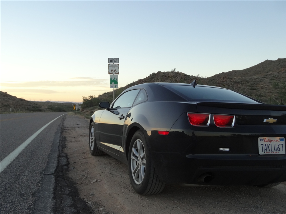
West of El Paso we entered New Mexico, another state alongside our route, where we spent another night on some remote campground. The following day was another day of desert driving as we left New Mexico and entered Arizona. It is a truly remote corner of the US. It is effectively just a desert crossed by the highway. Only a few small towns exist between Las Cruces (New Mexico state capital just 40 miles west from El Paso) and Tucson in Arizona. Some could say it must be a boring long drive. No way!! The landscape around is absolutely jaw dropping. It is a geology class without a need for books or maps. There is also this almost transcendental feel of going west towards the setting sun. It is a bit annoying from the driver’s perspective but it is just a minor problem.

After Phoenix we turned north towards the Grand Canyon. Nothing prepares you for its sheer size. You could see it many times on a TV, you can know all its statistics, and you might even say you are completely not interested in nature. It simply doesn’t matter. Once you stay on its edge and look down, you will be impressed. And you will remember this moment for many, many years.

Due to the high elevation you actually drive through the dense pine forest. You are not aware of the Canyon until the very last moment when the road ends, and there it is. Massive, enormous, colorful, simply amazing. After a cold night (again, due to the high elevation) spent on a campground not far from the Canyon we decided to hike down. Our choice was the popular Bright Angel Trail. The whole thing is a bit weird. Usually when you go to any mountain, first you climb and then you go down. Obviously with Grand Canyon it is the opposite. You start the day with an easy hike down, in a nice morning breezy air. The real fun starts when you have to climb back. By the time we decided to go back, sometime in the afternoon, the temperature had reached 35C or even more. Especially at the lower elevations (bottom of the Canyon is good 1500 meters below the rim), temperature is much higher than closer to the rim. Even we didn’t go all the way down, we still had about 1000 meters to climb. It took us quite a few hours to reach the top. We were exhausted but satisfied. Hiking is the best way to experience the Canyon. Views from the rim are amazing but you have to share them with millions of people. Going down, you leave 90 percents of them behind you.

Time. Time was our limitation. The same evening, after taking quick showers, we left Grand Canyon heading west again. It took us four and a half hours of desert driving to get to our next destination: Las Vegas. It was a great drive, the highway was almost empty and the sky was full of stars. Hours before reaching Las Vegas we spotted some brightness on the horizon. It got bigger and shinier with every minute. At the beginning we didn’t know what it was. Some small town, factory, or maybe a prison? Then we figured it out, they were the lights of Las Vegas. It is astonishing from how far you can see them across the dark and empty Arizona and Nevada deserts. Even if Vegas itself is still hidden behind the mountains.

For the proper “Wow” effect you have to arrive to Vegas at night. Believe me, I’ve seen it in the daylight and it looks much, much worse. But come darkness and there is nothing like Vegas. It is a one great show of neons, dancing fountains, fireworks, big cars and fast cars. Pure fun.

We arrived to Sin City at about 11pm and stayed for just a few hours, enough to loose a few bucks in a casino. Of course we didn’t win anything and left the neon metropolis by 2am. Because, as usual, we didn’t have any accommodation booked, we were just looking for a campground. And we couldn’t find one. We were so tired that we didn’t even realize how dodgy the campground we finally spotted at around 3am was. It was a very, very long day. We were hoping to wake up late, to recover from the previous hectic day (and big part of the night as well), but the strong desert sun made our tents as hot as an oven. By 8 am we were almost suffocated and totally awake. Damn it! We then realized that our campground was right next to the fence of the Air Force base, part of the famous area 51 (remember the X-Files?)

Another day, another desert. But this time it was the famous Death Valley, one of the hottest and driest places on earth. The record temperature was recorded in 1913, brain melting 134F (56.6C). By comparison we experienced quite a chilly day, just miserable 47C. It is still enough to make your eyes dry after you leave car for more than a few minutes. You really felt like you’ were drying out. But it is not all about the meteorological records. Death Valley National Park is full of unique scenery. Sand dunes, colorful rock formations and salt pans. And all this 85 meters below the sea level. Highly recommended.

After leaving Death Valley NP we drove west again, towards the Sierra Nevada, a really impressive mountain range, especially when you approach it from the east. Mountains rise from around the sea level to 4000 meters above in a very short distance. It is, basically, a massive wall raising straight from the flat desert. Very few mountain passes (usually closed in winter because of heavy snowfall) cross them. We chose Tioga Pass (3031m) which leads to the famous Yosemite. Before reaching the pass we passed lovely small towns like Lone Pine, Bishop, Independence or Big Pine. They are like oasis surrounded by the barren land. They are all full of friendly folks and live there goes slowly, all which make them antithesis of the stereotypical Californian towns. They are great places to stop, doesn’t matter if just for a meal or for a whole week.

We spent the night just before reaching the pass. At elevation around 2000m it was another short and uncomfortable sleep. This time the reason was not the heat, like last night, but the very low temperature. Our rubbish tents were completely inadequate for those conditions. I had all my clothes on me and it still didn’t help. So it was another day which started early (everyone wanted to heat up a bit inside a car). Next time I go camping I’ll take some proper tent and sleeping bag.

We crossed Tioga Pass and entered Yosemite National Park. In my opinion it is one of the best national parks in the US. The Famous Yosemite Valley (heart of the park) is more impressive than Grand Canyon (at least for me). True, it is a very busy place, better to avoid it in the middle of summer, but the scenery is absolutely awesome. Walls of granite rocks, some of them more than kilometer high, tower above the valley floor. Among them there is the magnificent El Capitan, the ultimate place to be for the rock climbers. Even if you don’t climb you will feel how small we are comparing with nature. You can spot small figures of climbers high in the wall. These people are totally crazy. Yosemite is also famous for its waterfalls which, unfortunately, almost disappear at the end of a dry summer (we were there in mid September), so the best time to see them is during the spring when snows are melting in the higher elevations.

It was pity we couldn’t spend more time in the park (just a few short hours), but our time was running out. We still had to reach the Pacific and then drive all the way back to Florida. So we left Yosemite in the afternoon and just before dusk we were approaching San Francisco. It was my first visit there, and the most memorable one. The mere crossing of the bay by the Bay Bridge is a great experience. It is a 14km double deck suspension bridge. And view of the downtown is truly amazing. Just before the night we also crossed the famous Golden Gate Bridge. And that was it, finally my dream of seeing Golden Gate was fulfilled. Maybe it is not the highest or the longest bridge, maybe views are better somewhere else, but for me this is the place I always wanted to see. For me it was the real climax of our trip.

We slept again in our tiny flimsy tents in Muir Woods National Monument. We knew there was a free campground, but before we got there, we got lost in network of small, narrow, curvy county roads. Fortunately because of that we could explore Marin County. It is a great place, houses are hidden in the dense forest, little towns are full of some cool coffee places, and all this in the commuting distance from San Francisco. The only problem are the high prices of everything (it is, at the end, one of the richest and most expensive counties in America).

After spending one day in San Francisco (itself destination worth a separate story) we finally started going back east. We had five days time left before we had to catch plane back to Europe in Miami. It was 5022km drive, and we did it actually quite easily. Driving 10-11 hours a day (starting 11am and going until midnight or so with some stops for eating and shopping) we still had some spare time to say goodbye to our friends in Orlando and to get a refund for our tents (Wal-Mart isn’t that bad at the end).

It was one of the best trips of my life so far, and I’m not exaggerating. It was tiring, it was crazy but it was great. So if you have two weeks time to spare, if you are ready to sleep in the middle of nowhere, if you don’t mind sleeping in the cheapest tents in freezing condition or in the desert heat, if you survive on the cheapest food from the cheapest supermarkets and if your bum can take 12 hours a day seating in a car, this is trip for you. But the most important thing, you need is bunch of great friends which won’t drive you mad if you stay together 24h a day in a small space for two weeks. Fortunately we made a great team.

How it all started.

I decided to start this blog to share my passion about travelling in America. Those who know me personally could confirm that I can talk about it for hours. I can bore them to death with all my past stories and future plans. Nonetheless I’ll try to write something interesting from time to time and not to bore you to death dear reader.

My love affair with America started many years ago. I was already exploring world while still in primary school but for years my travels were mostly virtual, using maps, books and imagination. It didn’t help that I come from a relatively small town in Poland and I was growing up during the transition of my country from communism into some sort of normality. It wasn’t easy to travel back then.

Quite quickly the fascinating geometric shapes of the American states got me especially interested. I read books about the US and I started collecting maps. Then there were movies, shot in all the amazing locations like California, NYC or the South West.

My American interests would probably stay a harmless geeky hobby if not one of my friends. I was studying geography at the time. Living on a small budget, when I did travel I did it mostly by hitch-hiking or taking the slow trains. I wasn’t really thinking about any far journeys, especially to America. At that point a friend of mine asked me if I want to join her and go for a summer job in Florida. I laughed at first, especially when I realized that the job offer was from Disney World. It all looked like a big joke. My English was bad, I didn’t have money for the ticket, I just couldn’t imagine it happening at all. I still don’t know why did I go for the interview and how did I pass it, but few months later, after borrowing money for the tickets, I landed in Miami.

It was 15 years ago. Since then I have travelled thousands of miles (about 40 thousands to be precise) in America. From coast to coast, from the Canadian border to Mexico, from the hustle and bustle of NYC or LA to the rural North Dakota, from the hot deserts of Arizona to the green forests of Vermont. I have visited 48 states so far (all the lower ones) and have a clear objective to visit all 50 of them.

I’m not an experienced blogger, actually I never wrote a blog before, but I’ll try my best to keep it interesting and I hope to inspire some of you to visit this fascinating country.