Canadian Rockies

Canadian_RockiesAfter years of procrastinating I finally managed to visit one of the most spectacular parts of the Northern American continent, the Canadian Rocky Mountains.

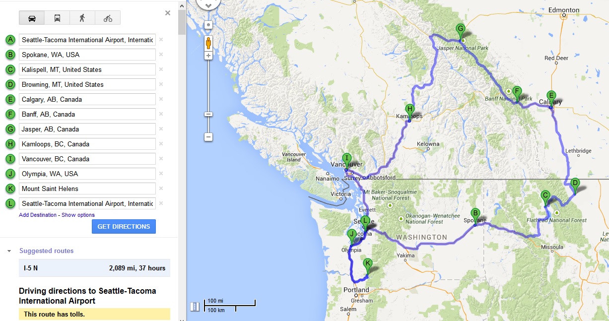
Most people visiting the Canadian Rockies start their trip either in Vancouver, which is the main gateway to the Canada’s west, or in Calgary, which, just an hour drive from Banff, is the closest big city to the mountains. We however decided to start in Edmonton as flights there (via Iceland) were significantly cheaper than to anywhere else in the region.

Edmonton welcomed us with grey and rainy weather which reminded us of London so we didn’t linger and after a night in cheap motel drove straight west to Jasper which is located over 350km (220 miles) away. It takes well over 3.5 hours to drive there and once you leave the suburbs of Edmonton it is an absolutely featureless drive for the first two to three hours (especially in a heavy and relentless rain). On our way we passed just a few small settlements and lots and lots of forest. Drives like this really help to understand how huge Canada is. On the map of Canada Edmonton seems to be almost on the footsteps of the Rockies but in fact you could fit half of my native Poland in that space. Or actually quite a few smaller European countries.

Jasper_early_morningLuckily as we were approaching the mountains the weather cleared somehow so we could admire some views. There were still a lot of low lying clouds but it stopped raining and there were even glimpses of sun. In those precious moments we could see the crazy colours of the glacial rivers flowing from the mountains.

Jasper is a small town at the heart of Jasper National Park but its population, counting just over 4000 souls, can swell enormously during the high season. For that reason we preferred to gamble with the weather and arrive there in late September to avoid the crowds. It seemed to work as the town was quiet and peaceful but not totally dead. We checked into our hotel and immediately hit the road again trying to enjoy the decent afternoon which was just developing.

Maligne_CanyonOur first stop was Maligne Canyon just a short drive from the town. It is nothing on the scale of the great canyons of the American Southwest but it is still an impressive sight and a great example of karst topography. Maligne River, flowing partially underground just above the canyon, eroded this chasm which is up to 50 meters deep but, in some places, only 2 meters wide. We walked along a very pleasant trail following the canyon and crossing it several times via high footbridges which offered great opportunities to look into the depths of the gorge.

From the canyon we drove a few kilometres up the valley to Medicine Lake which is not actually a lake at all but a geologic anomaly; it is an area into which the Maligne River backs up before suddenly disappearing underground. During the summer months, during intensified meltwater runoff, the lake (which during the winter months is just a meandering frozen river) fills to levels which fluctuate over time and with the runoff events. Much like a bathtub that is filled too fast for it to drain, it fills with water until the flow of water (in this case the meltwater runoff) reduces in late summer and it slowly drains again. As we visited the “lake” in September it was already much diminished but we could see where its waterline extends during the spring. Well over 10m higher than the level we saw.Medicne_Lake

Finally, we followed the valley up to the end of the road at the banks of the Maligne Lake. On the way up we encountered dark clouds, fog and even a few snowflakes but luckily a few minutes after our arrival the weather cleared again. We wrapped up (the lake is located 1670m above the sea level and we could feel it) and walked along its banks for a while. The views across the lake are truly spectacular. I found it almost impossible to stop taking photos, especially as the changing light and moving clouds constantly played with the spectacular mountain landscape. But it was getting late and cold so we decided to head back to Jasper town as the last thing we needed was to get stranded if the weather turned really bad. We spent the evening in a cheerful local pub enjoying some Canadian beer and whisky before going to sleep early.Maligne_Lake_1

The next day started really early. We woke up before the sunrise and had breakfast at 7am, basically as soon as the local bakery/cafe opened. There were two reasons for that. First, we were not yet completely adjusted to the time difference from Europe and second, we had a lot of ground to cover that day.

We headed south from Jasper town and joined one of the most spectacular roads on earth, the Icefield Parkway. Completed in 1940 this 232km (145 miles) long route parallels the Continental Divide and links Jasper with Lake Louise in Banff National Park. Like the Pacific Coast Highway in California it is one of those roads where one has to work very hard trying to concentrate on driving as the landscape is simply amazing. With every turn there is a new breathtaking vista opening up and wherever you look there are impressive wild mountains. It is one of these experiences which I find impossible to describe. I could post 10, 50, 100 pictures here and still it wouldn’t do it a justice. Icefield_Parkway_1

We kept stopping every few kilometres to take more and more photos and simply to admire the views but our first longer stop was at the Columbia Icefield just over 100km from Jasper. There is a huge visitor centre there, clearly designed to deal with the busloads of people coming there in the high season and once again we were thankful we came off season. We headed straight for the trail leading to the the face of the Athabasca Glacier which is one of the principal “toes” of the Columbia Icefield, the largest icefield in the Rocky Mountains. To get onto the glacier itself one has to be driven there in special vehicles or join a guided tour. Both options were quite pricey and our time was limited (as we were planning some hiking in the Lake Louise area) so we just walked along the trail close to the Athabasca Glacier face which was still the closest I have ever come to any glacier. Along the trail and along the road to the parking lot there are clever signs indicating where the glacier extended to at different times in the past. It is incredible to see how much it has retreated in the last 100 years.

Then we headed south again. After stopping for lunch at Saskatchewan Crossing, which is the only gas station and one of the few places serving food along the parkway, we reached the Bow Pass. At an elevation of 2068m (6785 feet) above sea level it is the highest point along the Icefield Parkway (and the highest public road in Canada). From the pass a short road and a trail lead to a viewing point overlooking the stunning Peyto Lake that is a crazy turquoise colour due to significant amounts of glacial rock flour flowing into it. At that elevation there were a few cm of snow on the ground and it was really cold. On top of that a tour group which reached the viewing point soon after us unceremoniously shifted us aside (have you aver experienced older ladies using elbows?) and started taking countless selfies so we decided to leave and sped straight to Lake Louise. Peyto_Lake_1

Actually our “speeding” involved one more stop, on the banks of Bow Lake, where we had hot tea and biscuits in the Num-Ti-Jah lodge. Finally, in the early afternoon we arrived at the banks of the intensely turquoise Lake Louise right beside the enormous (and quite ugly) Fairmont Chateau Lake Louise Hotel. It is an absolute monstrosity and with its huge parking lots and crowds strolling along the banks of the lake it all made us want to escape ( I don’t even want to think how bad it can get there in summer).

Lake_Agnes_TeahouseLuckily it is easy to do as there are some great hiking trails starting by the hotel. We chose to hike to the Lake Agnes Teahouse via the Little Beehive overlook and after leaving the lake and climbing for few hundred meters the crowds were a distant memory and we could enjoy the mountains again. For most of the distance the trail goes through the forest but at the Little Beehive there are fantastic views of the Bow Valley and Lake Louise. Once we got there we experienced a mix of sunshine and snowfall which really played with the landscape making everything look a bit haunted. On the way down we stopped in the teahouse at Lake Agnes for a well deserved hot beverage and some cake. The isolated teahouse is manned by a team which stays there for a few nights at the time as there is no road access. The bulk supply come by a helicopter at the beginning of the season while the perishables travel on the staff’s backs when the shifts change. It is a great little place, peacefully located on the banks of small but stunning lake. Birds and chipmunks were playing around collecting crumbs and begging for more leftovers while the sun was getting low. Unfortunately it was time to head back down. Lake_Agnes

The trail to the teahouse via Little Beehive is about 9km (5,5 miles) long (return) and involves about 500m (1640 feet) of elevation gain. I highly recommend it to anyone visiting Lake Louise.

After getting back to the car we joined the Trans-Canada Highway and headed west to Kicking Horse Pass (what a great name) and further to British Columbia. But that’s the subject for another story as we were leaving the Canadian Rockies.

I have to say I loved every minute we spent there. Sure the weather wasn’t perfect but the autumnal feel we had experienced added something to the perception of the place. True, the landscape is stunning in every weather but trees with leaves changing colours, the dusting of snow on the mountaintops, ominous heavy clouds and patches of fog in the valleys as well as the chill in the air, made the mountains feel more wild than they would seem in the glorious mid summer sunshine. On top of that we avoided crowds on the trails and traffic jams caused by thousands of RVs descending to the region every summer. In my opinion autumn is the best season to travel in this region.

Oh, and one day I really want to head further north, all the way to Alaska. One day…Bow_Lake

Eastern Washington

Washington State is often nicknamed the Evergreen State. That name says it all. It is a land of lush evergreen forests, high mountains, torrential rivers and eternal rain and mist Or is it?

Actually, the above description fits only the western third of the state. East of the Cascade Mountains exist a completely different Washington state. A land of open spaces and dry landscape. Like on this photo:East_of_the_Cascades

We drove there via the spectacular Columbia River Gorge heading east from Portland, Oregon. (I wrote more about it here). While following the Columbia river, which cuts through the barrier of the Cascades, we could see the landscape changing with every mile. We started our drive in a typical coastal Pacific Northwest, with greenery and waterfalls, but after less than 2 hours we were driving across windswept hills covered with dry grasses and barren basalt rocks. We crossed to the north bank of the river and climbed up the basalt cliffs of the gorge on US Hwy 97. The sun was about to set so we stopped to admire the spectacular views towards the west where Mt Hood and Mt Adams were looming over the open plains. It was absolutely amazing. Moments like that are the reasons why I love driving in America.Mt_Adams

After leaving the gorge we headed towards Yakima where we spent a night in yet another chain motel in one of its endless suburbs. Yakima is the centre of a rich farming region producing, among other things, wine as well as hops. In fact Wikipedia claims that the valley produces most of the nation’s hops. Still, we didn’t linger and took the Interstate 82 heading north.

That’s where the landscape quickly gets very spectacular indeed. The road climbs from the valley and crosses numerous ridges on its way to Ellensburg. While it is a major freeway, which is equivalent of a European motorway, it didn’t feel anything like that. The road was deserted, with very little traffic on it, and the two carriageways were often so far apart that we couldn’t see the other one. There were also excellent viewing points along the way. The first one, located at Selah Creek Rest Area soon after Yakima, offered a fantastic view of the Yakima valley and two snow capped volcanoes towering to the west: the 12,307 feet Mt Adams to the south and 14,410 feet Mt Rainier to the north. It seems like in this part of the world massive volcanoes are everywhere. The second viewing point was close to Ellensburg and offered a splendid panorama of the town as well as Mt Rainier (again) and the jagged peaks of the northern Cascades.Mountain_Viewpoint

In Ellensburg we joined the interstate 90 which, at 3020 miles (4861km) is the longest interstate highway in the USA. It connects Seattle with Boston but of course we weren’t heading that far (which was a pity as I would like to cross America from coast to coast again). We followed the I-90 only until the town of George where we turned to the north. Our destination was the dramatic geological formation of Grand Coulee.

Here I have to introduce a bit of geology. Don’t worry, just a bit.

Columbia_Plateau_BasaltsSo, for the last two days we were driving across a broad expanse of sagebrush covered volcanic plains and valleys, punctuated by isolated mountain ranges and dramatic river systems. This barren region is called Columbia Plateau or sometimes Columbia Basin and it is one of the world’s largest accumulations of lava, covering hundreds of thousands of square kilometres to the depths of 6000 feet and more. The landscape here is relatively young as the plateau formed only between 6 million and 16 million years ago as a result of successive flows of basalt. Since then major rivers like Columbia, Snake and their tributaries have cut impressive gorges through the plains.

And then there is the Grand Coulee which looks like a canyon of a major river with a slight problem. There is no river in it. The mystery of the formation was solved only a few decades ago when a maverick geologist suggested that the coulee was created when a massive glacial lake was suddenly drained about 18,000 years ago after a glacial dam broke in today’s Montana. It is now a widely accepted theory and scientists estimate that this massive lake was drained in just 48 hours. The flow would have been equivalent to ten times the combined flow of all the rivers in the world. As you can imagine an event like that would leave some scars in the landscape. Literally.

Now parts of the Grand Coulee are used for water storage and irrigation channels. Water is pumped from the Columbia River at the Grand Coulee Dam creating large Banks Lake and some smaller ones.Grand_Coulee

We entered the coulee from the south along the State Hwy 17. Immediately the towering basalt cliffs, with its characteristic hexagonal columns, grew above the highway creating a truly spectacular drive. In fact Washington highways 17 and 155 are some of the most scenic roads I have ever travelled. With every turn a new panorama opened. It was impossible not to stop to take pictures. Midway through the coulee we stopped at the Sun Lakes-Dry Falls State Park which, exactly as the name suggests, is located at the site of the dry falls. The falls were created during the same cataclysmic floods which sculpted the Grand Coulee in the last Ice Age. It is a weird but scenic site. Imagine Niagara Falls without water, as if someone switched it off. In fact the Dry Falls are more than twice the height of Niagara (120 metres as oppose to 51). On top of the falls there is a viewing platform as well as small but interesting interpretive centre explaining the geology of the region.Dry_Falls

From the Dry Falls we continued north through the coulee (here filled by Banks Lake) to Grand Coulee Dam.

Built between 1933 and 1942 it is still one of the world’s largest dams (it was the largest concrete dam before the Chinese finished their Three Gorges one) and the biggest power station in the US. It is a gravity concrete dam which holds the water of the reservoir because of its sheer weight (unlike the arch dams which uses their shape to spread the forces to the abutments). The dam is 120 metres tall, more than one kilometre long and contains over 9 million cubic metres of concrete. That’s enough to build a highway from Seattle to Miami. In short, it is a damn huge thing wGrand_Coulee_Damhich I simple couldn’t skip while being in the vicinity. So we decided to join a tour.

After visiting Hoover Dam a couple of years ago I was expecting a good experience but I was totally wrong. First, there was the ridiculously strict security which felt more strict than in most airports, with all the metal detectors and X-ray machine just for wallets (as bags were not allowed at all). Then during the tour we were constantly followed by a heavily armed guard. I mean a guy (in places more than one) in bulletproof armour and holding a nasty looking long gun. Come on, we were a bunch of people (some quite elderly, others quite obese) with no bags or other ways of hiding any serious weapons. I had a feeling that everyone was just a bit bored in the remote small town around the dam and hoping for some excitement. On top of that the tour itself was simply boring. We got down by the elevator to peek at one of the power rooms through the glass (again watched by a sniper with his tactical helmet on) and drove on top of the dam for a few minutes, but most of the tour was occupied by the security briefings and driving around the town from one side of the dam to another. Total waste of time. Skip it at least until they fix the glass elevator which will offer access to some more interesting areas of the dam.

So the tour itself was disappointing but overall our visit to the Grand Coulee was interesting. I always liked small remote places and big structures and here we had example of both. And there is also a great viewing point on a hill a few miles out of town which offers a great panorama of the dam and surrounding small communities.

From Grand Coulee we headed east towards Spokane. We took the state Hwy 174 and then joined US Hwy 2. The landscape changed again. We left the gorges carved in basalts behind and were now driving across gently undulating hills covered by huge grain farms. This region (together with the Palouse further south) is the breadbasket of Washington state. The dead straight roads cutting through this weird landscape created a strange driving experience, especially in the warm light of the low, late afternoon sun. It all really reminded me western Kansas.Perfect_Road

Yet one more of those moments for which I simply love travelling in the western USA.

Spokane itself was a bit of a surprise. We only really decided to check it out as it was conveniently located as a place to stop on our way from Grand Coulee to Montana. It has a small but quite pleasant downtown and we even found a very well supplied independent bookshop there. It is called Auntie’s Bookstore and it is surprisingly large Aunties_Bookstoreconsidering that Spokane’s population is just over 200,000 (half a million if we include the whole metropolitan area dominated by the wast suburbs stretching all the way to Idaho, more 20 miles to the east) and the city doesn’t have a reputation even remotely close to the likes of Portland, Seattle or some university towns. Yet the bookshop seemed to be doing well and I did my bit to support it by buying quite a few books.

But the main attraction of Spokane are the waterfalls and surrounding Riverfront Park. Right next to downtown Spokane river tumbles 60 feet down a narrow basalt (of course) gorge. The falls consist of upper and lower falls and look very scenic and wild but they are in fact quite heavily modified by additions of dams and power stations in the first half of the 20th century. However the terrain around is nicely landscaped and one can even ride a cable car above the falls. Right below the falls there is also a beautiful concrete arch bridge offering great views for free (if you don’t want to pay for cable car). In 1974 Spokane hosted Expo ’74 and the Riverfront Park was created back then in place of railway yards. Nowadays the park and the nice peaceful downtown made Spokane a perfect stop for us.Spokane_Falls

From Spokane we headed east towards Montana. The landscape changed yet again and we were now driving across forested mountains, for first time really since leaving the Cascades two days earlier. It was a clear sign that we were fast approaching Montana. In fact crossing the Idaho panhandle along the interstate 90 takes only about an hour.

But Montana, covering an area larger than Germany, is a huge and varied state which deserve a separate chapter.Mt_Hood

Texas

Mustang_in_TexasWriting about our last trip to the US I so far avoided the elephant in the room (literarily), the enormous state of Texas. It is time to rectify that issue as it was the place where we started and finished our last American adventure.

It wasn’t my first visit to Texas. I travelled its width in 2001 during my first visit in the US when we drove the entire 879 miles (1,415 km) of the Interstate 10, all the way from Louisiana to New Mexico. Since then I have also crossed the Texas Panhandle along the 177 miles of I-40, but our 2014 trip was going to be my most thorough exploration of the Lone Star State to date.

Spirit_of_AustinWe started our trip in Austin, a blue progressive dot in the conservative red sea of Texas. One reason was the fact that British Airways started flying there directly from London but more importantly it is one of the cities which is growing as a tourist destination and has a reputation of being a cool place. It seems that for once we decided to go somewhere trendy. So how was Austin?

It welcomed us with glorious afternoon sunshine and high humidity. As a result as soon as we got to our motel room a huge thunderstorm ensued. It was an almighty deluge. The sky became virtually black, the temperature plummeted and there was hail and strong winds. It put to rest our plans for a late afternoon stroll around the town.

Luckily the following day started with beautiful sunshine and warmth. We began our tour of Austin with a visit to the Texas State Capitol. Located on a hill on the northern periphery of downtown it commands a sweeping view towards the Colorado River from its southern façade and is itself visible from many points in the city. It is a huge building. In fact, according to the State Preservation Board website, it is the largest state capitol in square footage. Its facade is clad in red granite and the interior offers symbolic decorations typical of any of the US state capitols. Local and national heroes lurk everywhere. A unique feature is the Texas star located in many corners, from the door handles to the chandeliers. We joined an enjoyable tour of the building and then had a picnic on the immaculately landscaped capitol grounds. Texas_Capitol

From the capitol we headed south along the dead straight Congress Avenue towards the Colorado River (not the one with the Grand Canyon). Along the way we admired a total architectural mix. From some old 19th century single storey buildings, through the beautiful 20th century Art Deco, to some modern shiny and bold skyscrapers. It is worth remembering that Austin is one of the fastest growing cities in America and its skyline is changing very quickly. We stopped in one of the many trendy cafés/shops and got ourselves coffee and tea. And I mean not the usual awful liquid you can get in the gas stations or in smaller towns across America but a proper tasty beverage. The shop was full of weird organic stuff and you could clearly see that Austin is different from than the rest of state. Congress_Ave_2

After a quick stroll along the river we headed back north, past the downtown, to the vicinity of the University of Texas campus. Located just a few blocks north of the capitol the university is one of the main reasons why the city is so different from the rest of typically quite conservative Texas. UT Austin is one of the richest and, with over 50,000 undergraduate and graduate students as well as over 24,000 faculty staff, one of the biggest universities in America. All those students and academics give the city a very positive vibe.

Texas_PterosaurWe had lunch in one of the funky places on the edge of campus before strolling to the Texas Memorial Museum which features great natural history artefacts. Its most impressive display is the skeleton of the Texas Pterosaur which hangs from the ceiling of the Great Hall. With a 40 feet wingspan it is one big beast. The building itself is also quite interesting with many Art Deco motifs.

All around the campus one can spot countless little and large heads of a Texas longhorns. It is the symbol of the university’s American football team, the Texas Longhorns. Now, let me explain that Texans are absolutely mad about football. Sure, it is sport number one anywhere in America but here in Texas it is more of obsession or even religion than sport. Let’s just say that the Longhorns stadium has a capacity of over 100,000, which is more than most European football teams can even dream about.

Overall Austin looked like a really pleasant city. One thing which we couldn’t experience was its famous nightlife as we were there during midweek and we had to leave it early on Thursday to continue north past Dallas to other states on our itinerary.

But we came back to the Lone Star state for a few days towards the end of our trip. We drove from Louisiana straight to Houston to visit the Lyndon B. Johnson Space Center. Remember the famous call: “Houston, we have a problem”? Yes, it is the place and we had to see it. There are a few drawbacks. It is bloody expensive and some bits of it feel more like a Disneyland than space centre, especially on Sunday, but in general we had a great time there.

Saturn_V_rocketThe highlight of the day was the tour of the Rocket Park which, amongst many others, includes the restored Saturn V rocket. It is made up of stages of three different rockets unneeded when the Apollo programme was scrapped and it is enormous. We joined a tour of the Saturn V led by one of the retired flight controllers, now probably in his late 60s or early 70s, who was a superb guide. Entertaining and informative, and crucially, someone who actually took part in many events he was talking about.

Other highlights of our visit included the Lunar Vault and the Starship Gallery. On the face of it, all looks like another science museum until you realize that you are looking at the real Apollo 17 command module. The actual last manned spacecraft to fly to the moon in 1972. In fact you can even touch it. Then, in the Lunar Vault, you can also touch a sample of the lunar rock. How cool is that? Sure, it is touched by so many people that you are probably touching the human grease but still, it is a piece of moon you can touch. One of only 5 such samples in the world.Apollo_17

There are many other exhibits, some more, some less interesting and there is enough to keep you busy for most of the day. Even the gift shop was fun as you can buy all sorts of cool stuff like, for example, astronaut’s freeze dried food…

From the Space Center we drove west straight to the picturesque Texas Hill Country. But first we had to navigate the enormous freeways of greater Houston. Some of the five level junctions are really impressive. In Texas the car is a religion and Texan roads are like temples dedicated to cars. Also, everything in the state has to bigger, bolder and more brash. On the other hand it is quite amazing how fast after leaving the cities and suburbs the roads become rural, peaceful and well landscaped. In fact the Texas Highway Department even has a wildflower management program and it buys and sows about 30,000 pounds of wildflower seed each year. The effect of all this is clearly visible when you drive along the Texas highways in spring (as we did). Millions of flowers blossom on the verges and in the wide median strip. Among them the most beloved by Texans are the strikingly blue Texas Bluebonnets, the state official flowers. There are even websites dedicated to reporting the blooming timings and the best viewing spots in the state.Bluebonnets_and-pickup

We spent the night in the vicinity of New Braunfels at the edge of the Hill Country. It is one of the fast growing cities of the I-35 corridor between Austin and San Antonio, a sea of low density suburbs. There we had an absolutely amazing BBQ in one of the local joints. I love proper American BBQ and this part of Texas offers some of the best in America.

Bad_Cofffee_in_TexasThe following day we headed west towards the heart of the Hill Country. It is a beautiful part of the state. Local quiet two lane roads navigate varied topography and join small peaceful towns. Unfortunately the day started with some intermittent rain which spoiled our fun a bit. At some point it was raining quite heavily so we stopped in one of the tiny settlements for a hot drink. Here my girlfriend had one of the worst coffees ever, accidentally getting some sort of weird caramel flavoured beverage which was supposed to be coffee but was far from it. Good I don’t drink coffee.

Northern_CardinalLuckily, the weather soon improved and we could proceed to the Enchanted Rock State Natural Area. Enchanted Rock is a prominent granite dome which offers some nice hiking and fabulous views from the top. We spent a few hours in the park, climbing to the top as well as circumnavigating the whole monolith. Apart from the views of the surrounding landscape we could also admire some local wildlife like for example the striking northern cardinals. These small red birds look really funky with their tiny “punk style” head feathers standing up, and most people will probably find them familiar due to the famous Angry Birds game. Enchanted_Rock_State_Park

Enchanted Rock was the westernmost point of our trip, from there it was time to head back towards San Antonio and Austin.

Texas_Hill_CountryThe next day was our last one in Texas as we had to fly back to London in the evening. Before going to the airport we headed to downtown San Antonio to see the Alamo. Now, I was never really that interested in seeing it as I was fearing Disneyfication of the whole experience. But as we were so close and had a few spare hours it would be silly not to visit the famous landmark.

What surprised me the most was its size. It is way smaller than I expected. But it was as touristy as I expected, with Disney style queueing system to enter the mission’s chapel. Despite that it was interesting to see the place we heard so much about, including from the guide at the state capitol in Austin, right at the beginning of our trip. From this perspective visit to Alamo was a nice closure of our 2014 tour of the southern USA.

And that’s was it. From Alamo we drove north to Austin from where we flew back to London.Texas_flag

Slow Road to Brownsville

Over the years I have read plenty of books about America. Some of them funny and light, some heavy and geeky volumes about niche subjects. Some great, some not so good. But recently I just finished one of the best volumes I have ever read about travels in the US.

Slow Road to Brownsville : A Journey Through the Heart of the Old West by David Reynolds is a classic travelogue describing his journey along Hwy 83, all the way from Manitoba to Brownsville on the Texas – Mexico border. Slow_Road_to_Brownsville

The author starts from the northern end of Hwy 83 in the small community of Swan River located in the Canadian province of Manitoba, 400 km north of the US border. He chose it as a starting point because of the connection of this place with his father who emigrated there when David was young. From there he slowly moves south through the Canadian and American Great Plains all the way to the Rio Grande.

Over the thousands of miles he drives Davis meets locals, visits small towns and local tourist attractions like historic forts or state parks. He drinks in local bars and sleeps in cheap motels, often run by people with an Indian background (I mean from the Indian Subcontinent rather than Native Americans). His clear objective is to drive every single mile of Hwy 83 but he allows himself to venture off to see the nearby sights as long as he doesn’t go more than 90 miles from the 83 and returns to the same spot where he left it before continuing further south.

I absolutely enjoyed this book and for a few reasons.

First, Reynolds writes very well, in clear, short and crisp sentences. His style is very descriptive as he explains precisely how the people he met were dressed, what cars they drove, what colour was his bed in the local motel, how the tap was leaking, how fat some people were etc. I could basically see what he was writing about in front of my eyes.

Here we come to the second reason why I really loved this book. It is easy for me to imagine what he writes about as he describes one of my favourite regions in America, the Great Plains. Hwy 83 runs quite close to the 100th meridian west, which historicaly represented the rough bounduary between eastern and western USA, between farming and ranching, and between humid and semi-arid climates. Those open speces in the middle of the continent are also my favourite places to roam around. In fact during my various trips I have visited quite a few places which Raynolds is writing about. As I was mostly traveling from east to west (or vice versa) rather than longitudinaly, as the author, my routes crossed with his in a few places only. Bismarck in North Dakota, Badlands National Park and Walls in South Dakota, Sand Hills of Nebraska, Dodge City in Kansas, Shamrock and San Antionio in Texas, that’s where our paths crossed. It is really fun to read about places I have visted, especially when the author’s impressions are similiar to mine.

And here is the third, and probably the most important, reason why I love this book. Basically it seems that the author’s ideas, impressions and feelings during his road trip are quite close to mine.

Sure, there are differences. For example he seems to be more surprised by some things than myself, but that might be due to the fact that I have roadtripped in the US quite a lot. Then, he prefers slow driving, I like speed. And most importantly, I would never drive a Toyota Prius across the Grat Plains. It is like ordering Coors Light in a London pub. Abnomination! Give me a Ford Mustang or Chevy Camaro, even a pick-up truck.

But our broad reflections seem to be quite similiar, even if there is a good 25 years between me and the author. Regardless of the fact that untill the age of 12 I lived behind the Iron Curtain I share Reynolds’ recollections of how US cinema created an image of the country long before any of us ever set a foot there. He was fascinated by westerns, I preferred crime dramas or road movies. Like Conwoy from 1978 starring Kris Kristofferson or Smokey and the Bandit from 1977 starring Burt Reynolds and featuring the East Bound and Down song, still one of the best driving tunes. Reynolds was playing with plastic figurines of cowboys and Indians while I was dreaming about big eighteen wheelers and fast cars. It seems that for both of us driving empty roads of the Great Plains brings countless memories of childhood plays and cinematic excitement. It also looks that for background Reynolds read a lot of the same books that I did. Grapes of Wrath and Travels with Charley by John Stainbeck, Great Plains by Ian Frazier, Bad Land by Jonathan Raban, On the Road by Jack Kerouac are only a few titles he mentions and which I also read.

A trip across those central states is more than just a physical movement from point A to point B. It is usually travel through preconceptions, with familiar iconinc landscapes rolling by and Reynolds describes this feeling very well. I wish I could do it as well as him.

I can recomend this book to anyone interested in real America, places far from the sophistication of the New York City, or the glamour of Hollywood or the tropocal paradise of coastal Florida. It is also a great travelogue, easilly in the same league with Steinbeck’s Travels with Charley, another book which I might write about soon.US Hwy

Interstate Highway System

Interstate_94_shieldA few weeks ago, while researching new titles about America which I could order for Stanfords, I came across a book titled Divided Highways: Building the Interstate Highways, Transforming American Life by Tom Lewis. I simply couldn’t resist and ordered myself a copy. Reading this fascinating book (more about which later) I realized that I wrote a lot about the US but never really much about one of the largest engineering projects in the world’s history, the Interstate Highway System. So, what is it?

Let’s start from its official name. “Dwight D. Eisenhower National System of Interstate and Defense Highways” somewhat convoluted, bureaucratic sounding, and nowhere near as iconic and famous as the Autobahn. But the interstates are much longer and have much bigger influence on the spatial development of America than the autobahns have on Germany.

In short, the Interstate Highway System is a federally founded network of controlled-access highways (commonly called freeways in America or motorways in Britain). At 47,714 miles (76,788 km) it is the second longest such network in the world, after China’s. For a comparison, if we add the lengths of all the famous German autobahns, French autoroutes, Spanish autovias and autopistas, Italian autostradas, British motorways and even Dutch autosnelwegs we only reach a figure of less than 26,000 miles (about 42,000km).Interstate_map

What is striking about the interstates (apart from their length) is how much they have influenced America in the last 50 years. That is of course true about roads in many countries but to a much lesser degree. Motorways in Europe connected existing dense cities often constrained in their growth by green belts or other planning rules. Europe also invested massively in all sorts of public transport. In other regions (especially Asia) comprehensive road networks are much younger and didn’t yet have time to influence those countries as much as is the case in America.

In the US the interstates allowed a massive spread of suburbs and geographic growth of cities. Some say that interstates caused the whole process, others argue that it was a logical response to trends which started long before (the first suburbs were actually built along the railway lines). One way or another, with the lack of alternatives, freeways (most of them interstates) shaped the country.Interstate_210_in_Greater_ LA

Most people who travelled in America must have come into contact with the Interstates. Sometimes it is only a brief encounter while taking a bus or a taxi from the airport to downtown but if you travel more around the country you are bound to end up doing lots of miles along the interstates.

That is the case with me. Over the last few years I have driven more than 31,000 miles across 47 states and two Canadian provinces. Of course I try to travel along the scenic and interesting routes as much as possible (like the Pacific Coast Highway in California, the Blue Ridge Parkway in the Appalachians or many many others), but let’s face it, I have also spent hours driving on the interstates. From the deserted stretches of I-15 in Utah to the busy urban I-10 in Houston or I-85 in Atlanta.Interstate_10_in_Houston


There is a trend among many travellers and travel writers to dismiss the interstates as boring, dull, somehow detached from the “real America”. Something to avoid at any cost, only accepted as a means of quick travel from one interesting place to another. I find it untrue and unfair. Because the interstates, along with all the commercial detritus along them, represent the real America nowadays. Not some trendy urban patches in NYC or San Fran, not even the small towns, often glorified as perfect images of America. Manhattan is great and lively but also full of tourists. Small towns which are not on the interstates are often depopulating and decaying. No, the real heartbeat of America you can only feel along the freeways. In the countless gas stations serving bad food and even worse coffee, in thousands of McDonalds and other fast food chains (often completely unknown outside America), in noisy motels, in shopping malls and generic suburbs, all connected by the interstates.Life_beside_the_interstate

There you can see the real flow of humanity. Soccer mums driving children to school in their shiny SUVs (which never go off road), immigrants in old banged-up Fords, or Chevys or Hondas (often barely holding together), travelling salesmen and executives in the generic rental sedans, bearded truckers in their 18 wheelers, pensioners driving their enormous mobile homes towards the sun, college kids towing U-haul trailers full of their prized possessions, along with many, many others. Women are doing make-up, people are eating or speaking on the phone, children are fighting in the back seats, dogs are barking at the back of the pickup truck, all along the interstates. In the mountains of Colorado, deserts of Utah, marshes of Louisiana, farmlands of Iowa, forests of Michigan or the suburbs of Atlanta, interstates are everywhere and everyone drives on them. And they are also nowhere near as boring as some snobbish people picture them. There are some really scenic stretches, especially in the western states, but not only there. Interstate_40_in_California

Interstates are all designed to the same standards and with the same signage. Some see it as a problem, something which makes them bland and boring. But I actually like this aspect of the Interstates. There is some reassuring feeling every time I take the slip road and join the network. It is like walking a familiar street or meeting an old friend. Besides, I’m always fascinated by ruthlessly efficient engineering and as roads go the Interstate Highway System is damn efficient.

Interstate_94_in_North_DakotaNow, you can understand why I simply couldn’t resist the book. As soon as it arrived I dropped all the other bits of reading I was doing at the time and indulged myself in the history and politics behind the building of the Interstate Highway System.

Tom Lewis is not a highway engineer, nor a planner, not even a historian. No, he is in fact a professor of English. That’s probably a reason why this book has very little about the engineering and much more about the history and politics behind the whole system. In the first few chapters Lewis describes the general history of road building and improvement in America. From the first turnpikes in the 19th century to improvement of the muddy farm lanes in Iowa and other Midwestern states at the beginning of the 20th century.

But of course the core of the book is about the Interstates. It is fascinating how much effort it took to create the modern roads, a thing which most Americans take for granted. Initially every state did things on its own, there was no general strategy and no standards. Good roads could turn into farm tracks at the states’ boundaries. There was chaos and little money. It was only under the presidency of Dwight D. Eisenhower raised in rural Kansas, that construction of the interstates was authorized by the Federal Aid Highway Act of 1956. Lewis describes in detail all the political manoeuvring and back room dealings to get the legislation passed as well as battles and debates between the engineers and politicians.Interstate_70_in_Kansas

There are a few theories why Eisenhower pushed for building a federal network of freeways. In 1919, as a young soldier, he joined the army’s first transcontinental trip by car and truck. It took the convoy 62 days to cross the country. In some places they couldn’t travel faster than 3mph. Later as a general in Europe during World War II Eisenhower learned the importance of the fast modern roads for moving large armies efficiently. He was especially impressed by the network of autobahns in Germany. Some people join these two stories and quote them as the main reasons why he pushed for the construction of the interstates.

Lewis argues that it was rather a case of economic development which could be spurred by a large construction project. Eisenhower simply wanted to avoid recession and also wanted to genuinely develop the country (a rare thing among modern politicians). One way or another it was this war hero turned politician who started the whole thing.

Interstate_10_in_New_OrleansIn the later chapters Lewis describes how the system was build and how it changed over the years. Initially mostly the rural stretches were built but eventually the interstates reached the cities. There the ruthless engineers pushed them across, often razing whole neighbourhoods on the way. Initially they were unstoppable but eventually local citizens pushed back. In San Francisco, NYC and New Orleans the local coalitions managed to stop construction of potentially massively disruptive roads. It is amazing how quickly the modern freeways were relegated from an amazing new thing that everyone wanted to a nuisance that everyone now wants to avoid.

The last chapter was only written for the 2010 edition of the book and in it Lewis describes the fascinating project of burying of the elevated freeways in Boston ( the, so called, “Big Dig”). There the elevated structure carrying I-93, and popularly referred to as the Green Monster, was replaced by a number of underground and underwater tunnels.Big_Dig_in_Boston

Apart from the history of the interstate highways’ construction Lewis also describes how they changed the country. For example businesses like McDonalds, Holiday Inn and many other chains, often based on a franchise model, were massively helped by the interstates. Every exit was a new business opportunity. Suburbs and shopping centres grew while population got more mobile and transport easier and faster.

In general I found Divided Highways a thoroughly absorbing book. Of course it helps that I am a road geek but I think it could be fascinating for anyone interested in American culture. The author is not some maniac road enthusiast, nor a hippy road hater, and he has managed to produce quite a balanced book.

At the end a bit of myth busting and a few facts.

Some say that one in five miles of the Interstate System is straight so airplanes can land in emergencies. Not true. This myth is widespread on the Internet and in reference sources, but has no basis in law, regulation, design manual—or fact.

The longest east – west interstate is I-90 from Seattle to Boston and it is 3020 miles long (4860 km) while the longest north – south interstate is I-95 from Miami to Canadian border in Maine which runs for 1920 miles (3088 km).

The highest point of any of the interstates is I-70 in the Eisenhower Tunnel at the Continental Divide in Colorado (3401m above the sea level) while the lowest is I-95 in the Fort McHenry Tunnel under the Baltimore Inner Harbor (31m below the sea level).

There are many more fascinating facts but let’s stop here as all this writing makes me want to hit the road again. Time to organize another road trip.OLYMPUS DIGITAL CAMERA

The Other Gulf Coast

Louisiana_Hwy_27When people think about the Gulf Coast they mostly imagine beautiful sandy beaches, clear blue sea and colourful cocktails slowly sipped on the porch. Such associations are all true but those things are not really what I’m looking for on holiday (apart, of course, from the cocktails).

So, during our 2014 exploration of the Deep South, we skipped these clichéd aspects of the Gulf and headed for swamps, marshes and industrial installations.

We left New Orleans and headed west on Interstate I-10. Very quickly (just a few miles outside the metropolitan area) the landscape got quite wild. Basically, after leaving suburban Jefferson Parish the only signs of human activity are the road and the utility lines running on multiple bridges and causeways. It feels as if you are driving on water. The experience is similar to the famous Overseas Highway (US Hwy 1) joining Key West to the rest of Florida, especially in places where I-10 and then I-55 run alongside Lake Pontchartrain.

For example, driving on I-55, we crossed the 36km (22 miles) long Manchac Swamp Bridge. Some people might call it boring but I found it an amazing drive. An endless ribbon of concrete suspended a few metres above the brackish swamp and cutting through forests of bald cypresses growing straight out of the water. It all looked absolutely awesome in the low light of the setting sun and with minimal traffic. This was Louisiana as I have always imagined it. Atchafalaya_Swamp

After spending the night in a small motel in the town of Hammond (where the lady at the reception was genuinely surprised to see a passport and said: “we don’t see many of those here”) we headed west again, crossing the Mississippi at Baton Rouge, and then drove on yet another long bridge over the swamps. The Atchafalaya Basin Bridge is “only” 29km long but still very impressive, crossing empty, wild and heavily forested Atchafalaya Swamp, the largest wetland in the United States.

Sam_Houston_Jones_State_Park_TrailNow, as much as I like bridges (which is a bit of an understatement as I should probably really call myself a bridge geek) it was time to leave the main freeways and get closer to nature.

We got off the interstate at Lake Charles and in 10-15 minutes entered the Sam Houston Jones State Park. This relatively small park (covering only about 1000 acres) offers a good introduction to the Louisiana landscapes. The park consist of woodlands, lakes and rivers but its most prominent feature is numerous bald cypress trees. We spent a few hours in the park (even getting “mildly” lost for a while) but failed to see a single alligator despite the multiple warnings about not feeding them. However, we did see our first wild armadillo and got very excited for that reason. Sam_Houston_Jones_State_Park

After leaving the park we changed the direction of our travel and now headed south as it was time to finally reach the open waters of the Gulf of Mexico. However close it looked on a general road map of the state it was still about a 30 mile drive passing endless marshes occasionally punctuated by tiny settlements or huge natural gas and oil installations By the way, let me explain the difference between swamps and marshes. Swamps are basically wetlands which are forested while marshes are dominated by grasses and reeds.

As we were driving south along the Louisiana Hwy 27 we left the wild dark swamps well behind us and were now enjoying open vistas over the marshes which really looked like a sea of grass. Along the route there are a few places with boardwalks over the marshes and while walking along one of them we finally spotted some proper, large, wild alligators. One of them was a really large beast indeed. Luckily they were not very active as they seemed to be enjoying an afternoon siesta.Alligator

We finally reached the Gulf waters where Hwy 27 joins Hwy 82. There was a small settlement consisting mostly vacation homes, empty at the time of our visit. Only a few folks were fishing and walking along the beach and it was all a far cry from the typical crowded beach resorts. This was the coast as I like it. Especially in the last few hours of the day when the sun is low and casting long shadows.

Meeting_Gulf_CoastNow we turned again and followed Louisiana Hwy 82 west along the coast, towards Texas. It was an amazing drive, straight towards the setting sun, one of those iconic American experiences. Especially as this sort of marshy, sparsely populated, low-lying coast is rather rare in Europe. The few settlements we passed on the way to Texas consisted mostly of a small number of houses on stilts. There was even a church, school and a fire station, all build on stilts. It really shows how vulnerable this coast is in the face of hurricanes. As much as I enjoy travelling in places like this I would never live here. It is just way too exposed. Additionally, if the current trends continue, most of this landscape will disappear under the waves in the next few decades.

Another factor which made our drive unlike anything I have experienced before was the offshore oil rigs visible on the horizon. In the distance they really looked like some alien spaceships, especially in the evening with their industrial lights switched on.

By the time we reached Sabine River, which down here marks the Texas-Louisiana border, the sun had just set and the light was quickly fading. Still, it was bright enough to see how the area was dominated by the energy industry. There were huge gas liquefaction plants under construction as well as an enormous oil refinery. All those miles of pipes, hundreds of tanks and thousands of lights created an otherworldly sci-fi atmosphere, especially with the deep red sky behind them. Industrial_Coast_of_Texas

Now, I know there are all the environmental issues, from global warming to coastal erosion, but on that particular evening, and from a purely visual perspective, all this industrial labyrinth looked absolutely amazing. Also, it is how big chunks of the Gulf Coast really look like, especial in Texas and Louisiana and I always want to see the real America not only the stuff from the tourist brochures.

This was pretty much our last taste of Louisiana and the wider Gulf Coast region as from now on we were heading inland towards Houston and then the heartland of the Lonely Star state.

I know that this chapter doesn’t describe any particular highlights but I really enjoyed our, a bit aimless, wanders between New Orleans and Houston, and I believe that if you have an open mind you can enjoy it too.Dont_Feed_Alligators

San Francisco 4th time lucky

San_FranciscoFor a long time I had a problem with this city even though, on the face of it, it is one of the most attractive places in America, if not in the world. But my visits here were always somehow spoiled.

The first one was in 2001. It was at the end of a long, trans-continental drive and we only had a few hours before we had to start our journey back to Florida. I did enjoy it but it was hectic and we were overwhelmed by so many sites on that crazy trip that it was hard to properly appreciate the city. You can read more about that visit here.

Next time I travelled to San Fran was in 2004 when with my mates we were driving along the Pacific Coast. This visit was even shorter than the first one, literally just an overnight stop in a dingy hostel in the downtown before heading out further north. Nothing to write about.

The third time I arrived in the Bay Area it was in 2009 during my long trip around the national parks of the American West. It was a glorious Saturday in June, I had three more days before my return flight to London and I was full of excitement. However, ludicrous crowds of tourists around Embarcadero and in the neighbouring areas quickly annoyed me enough to send me driving into the deserts. I stayed in the city less than 3 hours.

Finally in 2013 came my, so far, most fulfilling visit to the Bay Area. For a start we decided to fly to San Francisco directly, rather than arrive at the end of a long drive from somewhere else. Flying to SFO offered us a fantastic aerial view of the Golden Gate Bridge, the Bay Bridge and the downtown. From the plane window we could fully appreciate the city’s fantastic location.Golden_Gate_from_air

This time we also carefully selected our accommodation. We didn’t want noisy hostels in downtown or motels in some distant suburbs from where you have to drive for hours but we didn’t want to spend on expensive hotels either. Of course San Francisco is a rather expensive place to stay but we got round it by booking a hotel in Berkeley on the eastern shore of San Francisco Bay. This pleasant city is dominated by the oldest campus in the University of California system which gives it a very nice vibe. Most importantly, it only takes 22 minutes on the fast BART train to reach the Embarcadero station in San Francisco, way less than my daily London commute. All that meant that we could leave our Camaro at the hotel and head straight into town with ease.

Ferry_BuildingWe started our tour from the San Francisco Ferry Building. Built in Beaux Art style it was finished in 1898 and its 245-foot clock tower was designed after the Giralda bell tower in Seville. It is a very impressive structure indeed. A few ferries still use it as a terminal but most of the building is nowadays converted to shops and offices. Still, I could easily imagine it being busy with thousands of ferry passengers which disembarked here daily before the Bay Bridge was built. From the neighbouring wharves we could admire the impressive span of the Bay Bridge itself. It is a fantastic bridge, if you ask me, and one of my favourites. It looked absolutely stunning in the early morning sunshine with some lingering fog and mist. Bay_Bridge

From the ferry building we walked through the Financial District admiring its varied architecture (including the iconic Transamerica Pyramid) heading towards the Telegraph Hill and a site which I always wanted to see but somehow never managed to during my previous trips, the Coit Tower. Built in 1933 it is a 64-meters tall Art Deco structure made of unpainted reinforced concrete. Inside, at the base, there is a small exhibition and a gift shop but the most interesting aspects of the interior are the murals. They showcase some strong leftist and Marxist ideas and depict life in California during the Depression. Workers of all races are shown as equals, often in the heroic poses of socialist realism. Coming from Eastern Europe I always find this sort of art particularly fascinating. In the 1930s art in America had some elements really resembling the socialist art of Soviet Union.Coit_Tower

But what is best about the Coit Tower is the views from the top. Being located on a tall hill the monument offers a much better panorama than its modest height would suggest. Some of the sites visible include the Golden Gate Bridge, Alcatraz Island, the Bay Bridge as well as most of the densely built-up downtown San Francisco, including the Chinatown, Financial District and North Beach neighbourhoods.

After coming down we headed to North Beach. I was trying to find a small map shop which I visited during my first trip in 2001. After asking in a few places we learned that the shop shut a few years back. Pity. Now, as we were in the historic heart of the city’s Italian community, we treated ourselves to a tasty pizza in one of the local restaurants.

Cable_Power _HouseOur next attraction involved catching a ride onboard one of the historic cable cars. First we walked to the Cable Car Museum in Nob Hill. What is unique about the place is the fact that it is not only a museum but also a working cable power house that powers the cables running under the streets of San Francisco which still pull the famous trams. Visitors are able to view the working heart of the power house from an overlooking gallery as well as descend below the junction of Washington and Mason streets in order to view the large cavern where the haulage cables are routed via large sheaves out to the street. I found it an absolutely fascinating place, a living and working piece of history. From the museum we caught one of the trams running towards the waterfront. It was a fun ride as the tram was quite full and we had to stay on the steps outside holding fast as the tram hurtled down the hill towards the bay.SF_Tram

The Fisherman’s Wharf area was packed with tourists, so we headed west along the coast.

Our first stop was a bit inland, the Place of Fine Arts, and it was well worth crossing the busy road to get to it. The monumental structure was built for the 1915 Panama-Pacific Exposition and is one of its only few survivors. It avoided demolition after the exposition but it was not build from durable materials (it was effectively made of wood and plaster) and it was collapsing by the 1950s. It was finally rebuilt of steel and reinforced concrete in the 1960s.

Built around a small artificial lagoon, the Palace of Fine Arts consists of a wide pergola around a central rotunda and resembles giant ruins of some ancient Roman or Greek temples with all the columns and “classical looking”sculptures. It is an absolutely stunning and photogenic site. No surprise that it is very popular as a setting for photo shoots and weddings.Palace_of_Fine_Arts

The weather was fantastic so we decided to walk all the way to the Golden Gate. The coastal path is part of the Golden Gate National Recreation Area and it is a really pleasant trail. Finally, over 8km from the Ferry Building, we reached our furthest destination that day, the Fort Point National Historic Site. There was a fort in the narrowest point of the Golden Gate since 1794 when the Spanish built a castillo. However the bulk of the current structure comes from the second half of the 19th century when the US Army built a new fort.

What makes it a really spectacular place is the location: directly underneath the approaches to the Golden Gate Bridge. In fact the fort faced destruction at the time of the construction of the bridge but chief engineer Joseph Strauss redesigned the bridge to save the fortress. The end result is rather stunning. I love the juxtaposition of the 19th century brick and stone buildings of the fort dwarfed by the 20th century steel structure of the bridge. The Golden Gate Bridge is another of my favourite bridges and it was great fun to be able to admire it from this unique perspective. After driving across it some years ago, and later viewing it from the nearby hills, this time I had a chance to examine its elaborate underside.Fort_Point_2

From the Fort Point we headed back to downtown, stopping for a beer in some nice bar before finally reaching San Francisco’s colourful Chinatown after dark. I visited it during my first trip to the city and ever since then this one neighbourhood is one of my favourite parts of it.Chinatown We decided to finish our day by enjoying some tasty Chinese food in one of the affordable local restaurants. The food was great and the views from the window even better.

That was the last point of our one-day visit to San Fran and, as I mentioned already, it was my most enjoyable one so far. Hard to clearly explain why but it probably helped that this time I knew what I wanted to see (and managed to do it) and also wasn’t distracted by the usual first impression awe and confusion. I guess that is the advantage of repeat visits, especially to big cities. I had a similar experience with New York City. My second visit there was more fulfilling than the first one. I’m not saying that I don’t enjoy visiting new places but returning to some destinations simply offers a different, more insightful, perspective.

So, where should I go back to next? Seattle? Portland? Chicago? Or maybe Detroit? View_from_Coit_Tower

The Irish in American cities

The Irish WayI have just finished a fascinating book which I randomly spotted on the shelf of Stanfords a few weeks ago. It is The Irish Way by James R Barrett and it describes the role of the Irish in the main urban centres of America during the late 19th and early 20th centuries. It mostly deals with the situation in New York and Chicago but there are also references to Boston, Philadelphia as well as some mining and steel towns across the US.

Barrett is is a history professor at the University of Illinois and the book is written in quite a dense style full of facts and informations. It is not an easy or light read but it is nonetheless a very good book. I guess one of the reasons why I found it so interesting (apart of course from my general fascination in American history) is the fact that, to some degree, I can personally connect to its subject. Being Polish in London I’m a member of one of the biggest and, in the last few years, the fastest growing, minority group in a huge multi-ethnic metropolis. Not unlike the Irish in New York a 100 years ago.

Barrett describes in quite a lot of detail how the masses of mostly poor Irish immigrants in a space of a generation or two created effective social networks. This gave them great influence and helped them to shape the big American cities and, to some degree, the nation as a whole. In one of the chapters he deals with the role of religion and Catholic hierarchy which in America became effectively dominated by the Irish. In another he describes union movements and how much they were influenced and directed by the Irish even in later stages when a lot of members had different ethnic backgrounds. One of the most interesting chapters deals with the cities’ “party machines” (like for example the New York’s Tammany Hall) which also at some point became Irish dominated.

But one of the most interesting aspects of the book is how it describes interaction between the Irish and later big ethnic groups. In the case of New York the author concentrates on contacts and dealings between the Irish (by then dominant in many working class neighbourhoods), the Italians and the Jews, which started arriving in huge numbers at the beginning of the 20th century. In Chicago the dominant groups of newcomers were the Poles (and some other eastern Europeans such as the Czechs and Lithuanians) as well as the African Americans migrating from the south. For a lot of individuals from these groups the Irish became a model of how to fit into American society and how to achieve success. To a large degree it was the Irish who actually represented America to the newcomers. The average Pole in Chicago or Italian in New York had to deal with the Irish union officials, Irish policemen, Irish party bosses, Irish priests, Irish teachers etc. By the second and third generations most of the Irish were to a large degree Americanized and they were passing their social models to the Poles, Italians and the Jews. Barrett doesn’t shy from the darker side of all those interactions, like racism, discrimination and violence, but overall he paints quite an optimistic picture of what was happening.

The book is full of some interesting facts like for example how one of the Polish churches in Chicago was at some point apparently the largest catholic parish in the world and how it was fighting not to be dominated by the Irish hierarchy. Or how some Polish newspapers (also in Chicago) were urging its readers to became more like the Irish (by which they meant better organized to protect and advance themselves).

The author describes similar interactions with the Italians and Jews but of course for me the interactions with the Poles were the most interesting.

So, this book offers a fascinating description and explanation of processes happening in big American cities at the peak of the European immigration in the late 19th and early 20th centuries. It just happens that the Irish were probably the dominant players at the time. But can one learn anything from this book which is relevant in London today?

I actually think that a lot of the processes described in the book might be quite similar to what is happening nowadays. There are of course many differences. One of the most important is better communication which allows current immigrants to be more in touch with the home country (I still read daily news from Poland, thanks to the internet and visit Poland at least twice a year) as well as a bigger role of the state, from the basic social net to the anti discriminatory legislation. But there is still, as was back then, competition for the entry level jobs which often leads to efforts to protect those jobs for compatriots, and there is still racism and prejudice which current immigrants have to battle the same way the Irish had to deal with anti Irish prejudice from the protestant majority of the Americans. The other important factor is that the latest immigrants often deal with the previous wave more than they do with the indigenous population. For example Polish builders when they initially arrived to London they often worked under Irish supervision on the construction sites or rented houses from the Pakistani landlords. Nowadays the Poles are often themselves the foremen on the construction sites as well as the landlords and increasingly deal with more recent arrivals, for example from Bulgaria. There is also increasing a split between those of us who arrived to London a decade or more ago (about the time the EU enlarged) and the recent arrivals from Poland. The Irish experienced the same split between the fresh arrivals and the already established, often upwardly mobile immigrants.

Of course we will never be able to replicate what the Irish did back then in America. Our numbers are simply too low and many of us want eventually to go back home, but a book like this opens a new perspective on processes happening in a big multi ethnic metropolis, such as 21st century London.book collection


More plotting and planning…

Above the Great LakesAs I was writing in the last post, until I book the flights my plans are never really set in stone. The beginning of the year is often the time when I start probing prices of airline tickets even if my holiday is still months away. I never book them so early in advance as prices are often the best only 8-10 weeks before the flight dates, but it is still good to know what the average prices are at this early stage, and what the options are in terms of the airlines and the connecting airports.

So I started investigating flights to Denver and quickly realised that they are more expensive than I had anticipated. Direct flights were ridiculously expensive but even for the journeys involving inconvenient changes in America prices were still higher than I was hoping for.

British girls in SFONow, why is changing planes in America inconvenient? The biggest problem is the fact that you have to go through the immigration and customs at the first place you land in the US. It means that when you change, let say, in Chicago, you have to queue for immigration there, then collect you luggage, go through the customs and then check your bags separately for the remaining leg of the journey. It is a real pain and if the connecting time is short you can easily miss your flight. Especially as waiting for immigration can be absolutely unpredictable. I was once waiting over an hour in Chicago and I heard of occasions when people waited for 2-3 hours. The other problem is that American airports are not really designed with international changes in mind. International terminals are often separate from the others and connections are far from logical.

So I started thinking about other options.

I’m still committed to visiting Montana and the northern Rockies but the problem is there are really not that many big international airports there and all the smaller ones involve all the inconveniences I have mentioned above. I even investigated options of flying to Calgary and then heading south from there but it was becoming even more expensive than Denver.

Then I thought about Seattle. It is actually closer to the Glacier National Park than Denver and it opens the prospect of visiting more of Canada. I also remember it as a really nice place, albeit I haven’t been there for more than a decade. Conveniently I also found that the flights there are cheaper than to Denver. The cheapest option so far involves flying with Icelandair via Reykjavík; the change in Rykjavik is going to be much easier than in any of the American airports and also the journey time is broken into two convenient segments, three plus seven hours.

As I mentioned already, it is way too early to buy tickets as my plans can still (and probably will) change plus some other cheap deals may pop up in the meantime. But, it gives me the impetus to play again with maps (paper as well as digital) and start plotting some ideas for a trip. One of the latest results looks something like this:US and Canadian Rockies from Seattle 2

For now I have left one of my favourite places, Portland, out of the itinerary. I really like it but I have been there twice already and skipping it gives me more time to explore the Canadian Rockies, something I wasn’t seriously contemplating even a few weeks ago but an idea which was always on my personal long distance radar. In general the Pacific Northwest is another of my favourite American regions. And it is very varied too. It is not all about coast, mountains, rain and the temperate rainforest. For example the eastern Washington state offers dry, sparsely populated open spaces to drive through, almost like on the Great Plains. Also, I could finally see the famous Mount St Helens. I went there in 2004 but due to the weather conditions the visibility was so bad I couldn’t actually see the mountain itself. However, if the weather in September is bad I can spend more time in cities than in national parks so I could actually go and visit Portland after all. As I said, I’m always flexible with my plans, which are actually no plans but rather general ideas.

The biggest problem of my latest plans is the fact that I was kind of looking forward to visiting Denver and the surrounding areas. It is one of the biggest cities in the US that I haven’t visited yet and I have heard a lot of good stuff about the place. I even started thinking about flying to Seattle and coming back from Denver. Such, so-called “open jaw”, tickets seem to be not that much more expensive but unfortunately fees for the one way car rental are much higher than I was hoping for. For the moment then I have abandoned such plans.

It all leaves me with the ideas shown on the map above. It literally is just a few days old so I don’t even really know where to stop and what to see, for example between Seattle and the Glacier National Park, but at least I have something to focus on. Now I can enjoy another of my favourite pastimes, reading guidebooks and consulting maps and atlases of the places I might visit. It is something I never get bored of. I can also start looking for some interesting travel writing or history books about the region.

In the meantime I’m just finishing an fascinating book about the Irish in American cities so the review is coming here soon. OLYMPUS DIGITAL CAMERA